A car changes what a Baguio trip feels like. You leave when you want, stop for strawberries or a toilet break without asking anyone, and carry the jackets, the pasalubong and the extra bag of groceries your family insists on bringing. You also take on a mountain climb, a stack of toll gates, a coding scheme most visitors only hear about on arrival, and a city where finding a parking slot on a Saturday can take longer than lunch.
From Metro Manila, most drivers head up NLEX, SCTEX and TPLEX, leave the expressway near Rosario in La Union, then pick one of the mountain roads into the city. Marcos Highway is the dependable main climb. Kennon Road is the old scenic way up and opens or closes depending on the weather and repairs. Naguilian Road makes the most sense if you are coming in from the La Union coast.
This guide walks through each road and when to use it, how the weekday number coding works for out-of-town plates, where to leave the car in the city centre, and the mountain-driving habits that keep the trip calm. Read it alongside the official advisories on the day you leave, because the roads change faster than any blog post.
Is it worth bringing the car?
It depends on what the car will actually do once you arrive. A private vehicle earns its keep on the trip up and on outings beyond the centre: La Trinidad, the northern attractions, or a loop further into Benguet. Inside the downtown grid it is often slower than your own feet. The streets are steep and narrow, intersections jam quickly, and every new stop means hunting for another slot.
Bring the car
Families, heavy luggage, side trips
Worth it if you are travelling as a group, carrying a lot, or planning days in La Trinidad and other parts of Benguet.
Park it and walk
A downtown-only weekend
If the plan is Session Road, Burnham Park, the cathedral and the market, the car will mostly sit in a lot. Walking and taxis are easier.
The sweet spot
A hotel with secure parking
Drive up, leave the car at your accommodation, and take it out only for trips beyond the city centre.
Manila to Baguio by car: the main route
The expressway half of the trip is the easy part. Signage is clear, the roads are wide, and the only real variable is traffic. The work starts once you leave TPLEX and the land begins to tilt upward.
The usual drive north
Metro Manila to Baguio City
ExpresswaysNLEX, SCTEX, TPLEXRFIDEasytrip and AutosweepTollsCheck current rates
-
Step 1
Head north on NLEX
Leave Metro Manila on the North Luzon Expressway. An early start helps with city traffic, though it will not empty the road on a holiday.
-
Step 2
Switch to SCTEX toward Tarlac
Follow the signs for the Subic–Clark–Tarlac Expressway and stay on it toward Tarlac.
-
Step 3
Ride TPLEX to the Rosario end
Join the Tarlac–Pangasinan–La Union Expressway and stay on it until it ends at Rosario, La Union.
-
Step 4
Pick your way up the mountain
Choose Marcos Highway, Kennon Road or another approach based on that day's road advisory, not on habit or a map app's suggestion.
About travel time: skip fixed estimates on long weekends, Holy Week, Christmas and Panagbenga. Queues can start well before the climb and carry on into the city.
Sorting out RFID and tolls
NLEX and SCTEX run on Easytrip, while TPLEX uses Autosweep. Interoperability rules and account requirements have changed before, so check what your vehicle needs before the trip and top up every account you will use. Your total toll depends on where you enter and exit, your vehicle class and the rates in force that month, so look them up on the operators' own channels rather than trusting an old cost breakdown.
Toll prep in five checks
- Balance: load enough on each RFID account before you reach the first gate
- Sticker: make sure it is properly installed and readable
- Backup: have another way to pay in case a reader fails
- Rates: look up current tolls on the official expressway channels
- Rental car: ask the provider how tolls and RFID loads are handled
Which mountain road should you take?
Three roads get mentioned the most, plus a fourth that authorities sometimes point drivers to. They suit different situations, and the best one on paper is not always the one that is open, so let your starting point, your vehicle, the weather and the latest restrictions decide.
Marcos Highway
Officially the Aspiras–Palispis Highway, from the La Union sideThe sensible default for most drivers. It is a principal paved route with a steadier climb than Kennon, which makes it the usual pick when Kennon is restricted. Buses and trucks use it too, so expect slow uphill stretches on busy days, along with long curves, fog in places and the occasional lane closure for slope work.
Watch for: steep curves, poor visibility in rain, road slips and heavy vehicles
Kennon Road
Rosario area to Baguio, past the Lion's HeadThe historic road up, with forest views and the Lion's Head landmark along the way. When it is open it can be a shorter approach from the Rosario side. It is also the road most exposed to rockfalls and landslides, and access has been limited many times for safety and repairs. In late August 2026, DPWH-CAR reopened it to light vehicles with a five-ton load limit, and warned that non-residents could be turned back during continuous heavy rain. Take that as history, not as a promise about your travel date.
Watch for: closures, vehicle limits, one-lane repair sections and rockfall after rain
Naguilian Road
Baguio–Bauang Road, from Bauang, La UnionA good fit if you are pairing Baguio with a few days on the La Union coast, or if the other roads are jammed or restricted. The climb is long and winding with plenty of elevation changes, so it is not automatically quicker. Give yourself extra time if you have never driven it.
Watch for: blind curves, long descents that need a low gear, shifting visibility
Asin–Nangalisan–San Pascual Road
Alternative connection to the La Union boundaryRoad advisories sometimes name this route for vehicles that should stay off restricted parts of Kennon Road. Use it when authorities tell you to, after checking its passability and any limits on your vehicle. It is not a shortcut to try just because a map shows a thinner line.
Watch for: current passability and vehicle restrictions in the latest advisory
The four approaches side by side
Always confirm with the day's advisory
| Road | What it is like | Use it when | Main caution |
|---|---|---|---|
| Marcos Highway | Major highway with a long, steady climb | You want the principal route up | Curves, weather, road works and traffic |
| Kennon Road | Scenic, winding and historic | It is officially open to your vehicle and the weather is fine | Closures, landslides, rockfall, load limits |
| Naguilian Road | Longer winding approach via Bauang | You are coming from western La Union or it is advised | Long curvy sections, changing visibility |
| Asin–Nangalisan–San Pascual | Alternative mountain connection | Authorities direct traffic there | Confirm passability and restrictions first |
The simple rule: take whichever road the authorities say is safe and passable on the day you drive. A shorter scenic route stops being a good idea the moment there is a closure, a landslide warning or a load limit your vehicle breaks.
Baguio number coding for visitors
Baguio runs its own weekday coding scheme, and it covers visiting cars as well as local ones. A plate from outside Benguet does not get a pass. The schedule below is the one posted on the city's official VISITA tourism portal.
Where the coding applies
Not every road in the city. The restriction covers a designated coding zone, and the VISITA portal publishes a map showing the zone, its perimeter roads and the entry points. Perimeter roads can be treated differently from streets inside the zone, so a friend's description or a screenshot from last year is not good enough. Open the current map on the Baguio VISITA advisories page and trace the exact streets you plan to drive.
Are tourists exempt?
No. The city's tourism portal says so directly. A hotel booking, a tourist registration or an out-of-town plate does not give you permission to drive inside the zone on your coding day.
What to do if your plate is coded on travel day
- Arrive outside coding hoursIf your schedule allows, enter before 7:00 AM or after 7:00 PM. Arriving early does not let you keep driving in the zone once enforcement starts.
- Leave the car at your hotelBook a place with confirmed parking, then walk or ride taxis to the central sights for the day.
- Spend the day outside the zoneOnly after checking the official map and confirming your whole route stays out of the restricted area.
- Move your downtown dayIf the itinerary is flexible, schedule your central Baguio driving for a day your plate is free.
Where to park in Baguio's city centre
Parking is where most driving trips to Baguio go sideways. The centre pulls in shoppers, commuters, residents and visitors all at once, and there is not much road to share. The calmest approach is to choose a lot close to the area you want to see, park once, and do the rest on foot. Posted rates and hours change, so read the sign at the entrance before you commit.
Burnham Park pay parking
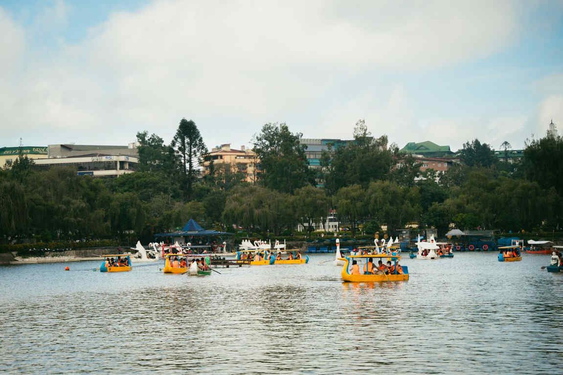
Around Burnham Park and the Athletic BowlPublic pay parking around the park, including Burnham Pay Parking, puts you within walking distance of the lake, nearby restaurants and the downtown streets. Slots near the park go quickly on weekends and holidays, so have a second option in mind instead of idling in a queue that blocks traffic behind you.
Best for: a day around Burnham Park and the nearby downtown area
SM City Baguio
Luneta Hill, near Upper Session RoadA paid facility serving the mall, handy if you plan to shop, eat or use the mall as a jumping-off point for Upper Session Road. Follow the marked vehicle entrance and exit, and check the posted rates, payment rules and closing time as you go in.
Best for: mall visits, meals and errands on Upper Session Road
Joem Parking Building
Mabini Street, city centreA parking building in the middle of town, a short walk from Session Road, Baguio Cathedral and the shops around them. Confirm its hours before you leave the car, especially if dinner might run late.
Best for: parking near the central business district and walking from there
Baguio Cathedral pay parking
Fr. Carlu StreetPaid parking near the cathedral works well for a visit to the church and short walks around downtown. Ask the attendant about the rate and whether the area is meant for visitors or churchgoers, because neighbouring lots can follow different rules.
Best for: cathedral visits and a quick loop around the centre
Kisad Road and Jose Abad Santos Drive
Edges of Burnham Park and the Athletic BowlMore pay parking sits along these roads, useful when the obvious Burnham lots are full. Navigate to the actual vehicle entrance, since a map pin may only mark the general area, and expect fewer slots during events.
Best for: drivers happy to walk a few extra minutes to the park or downtown
Once the car is parked near the lake, our guide to Burnham Lake boat rental prices covers the current rate and the best time to get on the water.
Parking habits that save you trouble
- Ask the hotel firstIs parking included, paid, first come first served, or reserved? Will it fit your vehicle?
- Check overnight rulesFind out whether you can leave the car overnight and when you must pick it up.
- Keep cash handyNot every lot takes digital payment.
- Read the sign, keep the ticketCheck the posted rate before you enter, not after you exit.
- Hide your thingsNo bags, gadgets or valuables left in view.
- Skip the "free" kerbAn empty roadside space is not always legal. Stay clear of sidewalks, crossings, intersections and no-parking signs.
Drive around town or take taxis?
For most visitors the answer is both, at different times. The central district is compact enough to walk if you do not mind slopes and a change in the weather, and taxis fill the gaps when a destination is farther out or the hill is too steep. That way you are not hunting for a new slot at every stop.
The trip up and the side trips
Use it for the drive to Baguio and for places outside the central district.
The downtown cluster
Burnham Park, Session Road, the cathedral and the market sit close enough to link on foot, depending on where you parked.
Far stops and bad weather
Flag one when the next stop is across town, the climb is steep, or the rain sets in.
Picking the right base makes this much easier. Our guide to where to stay in Baguio City by area shows which neighbourhoods put you within walking distance of the centre.
Best time to make the drive
Leaving Metro Manila early helps you dodge some city traffic, but it is no guarantee of a quiet expressway or a clear mountain road. What matters more is which day you pick.
Weekdays
The easiest days
Ordinary weekdays outside holidays and big events are kinder for driving and parking. Just check which day your plate is coded before you plan a downtown day.
Weekends and holidays
Expect company
Friday afternoons, Saturdays and the Sunday drive home get busy, more so in the cool months and on long weekends. Book a room with confirmed parking early, keep dinner reservations loose, and plan to leave the car at the hotel for most of the stay.
Rainy season
Check twice
Heavy rain raises the risk of landslides, rockfall, road slips and sudden closures. Look at the advisories before you leave home and again before you start the climb.
Mountain driving habits that keep the trip calm
Nobody wins anything by rushing the road to Baguio. Even confident drivers do better when they slow down and drive to the terrain.
Six habits for the climb and the drive back down.
Get the car checked
Brakes, tyres, lights, wipers, coolant and battery. The brakes matter most, since the long descent works them hard.
Let the gears do the work
Drop to a lower gear on long downhill stretches instead of riding the brakes. If you smell burning or the pedal feels wrong, pull over only at a safe, marked spot.
No overtaking on blind bends
Stay in your lane. Trucks and buses swing wide on curves, and oncoming cars appear with little warning.
Low beams, not high
Turn your lights on so others can see you in rain and fog, but skip the high beams. They bounce off thick fog and make it worse.
Leave a bigger gap
Wet roads and downhill grades make hard braking harder. Give the car ahead more room than you would in the lowlands.
Trust the barricade over the app
Navigation apps can miss a fresh closure. Follow road signs, traffic enforcers and official advisories, and save your photos for proper viewpoints, not narrow shoulders.
Before you leave home
The night before
- Road advisoriesCheck DPWH-CAR for Kennon Road, Marcos Highway, Naguilian Road and any alternative routes, and confirm your chosen road is open to your vehicle.
- WeatherLook at the forecast for the mountain areas, not just Manila.
- CodingMatch your plate to the weekday schedule and open the current coding-zone map on the VISITA portal.
- Parking and tollsConfirm hotel parking, then check RFID balances and current toll requirements.
- The car and the cabinInspect tyres, brakes, lights, wipers and fluids. Pack a phone charger, drinking water and basic emergency supplies.
- Offline backupsSave your accommodation address and a second parking option for when the signal drops.
Official pages worth bookmarking
- Baguio VISITA tourism portalThe city's official visitor site, with the number coding zone map.
- Baguio City traffic monitoringRoad conditions, incidents and alternative routes inside the city.
- Department of Public Works and HighwaysLook for DPWH-CAR updates on the mountain roads before you leave.
Is driving to Baguio a good idea?
Yes, if you want flexibility, you are bringing family, or your plans stretch beyond the city centre. The drive is very manageable with a checked car, a route picked from that day's advisory and enough slack in the schedule for the climb.
Two things deserve the most planning: the state of the mountain roads and the coding scheme. Kennon Road is lovely when the authorities say it is open to your vehicle, and only then. Marcos Highway and Naguilian Road are solid alternatives that still need a look at current conditions. Once in the city, a hotel with secure parking does more for your mood than any shortcut, so park, walk the centre, and save the car for the trips that need it. If you have a free day with the car, our list of day trips from Baguio has a few drives worth the fuel.
Comments
No comments yet. Been here recently? Share a tip or ask a question.
Leave a Reply