Mount Manunggal, in Balamban on Cebu's western side, is where the presidential plane carrying Ramon Magsaysay crashed on 17 March 1957. The crash site is a 30-minute walk from the campsite at Mt. Manunggal Eco-Adventure Park, which itself is roughly two to three hours from Cebu City by road. If you would rather earn the view, longer trails from the city's mountain barangays take three to five hours or more. Whichever you choose, bring cash and check the weather first, because the road that gets you there is the part that can go wrong.
The peak is not the draw. The commonly quoted height is 982 metres, which makes it Cebu's third-highest mountain after Osmeña Peak and Lugsangan Peak. What brings people is the memorial near the top, set in quiet upland country that you can reach on foot.
It also makes a sensible day trip for anyone who has already done the Busay stops and wants to go further up the same road. The whole mountain sits inside the Central Cebu Protected Landscape, so the air is cooler than in the city, and mornings can feel properly cold.
What Happened on the Mountain
The aircraft was a Douglas C-47 named Mt. Pinatubo. It took off from Lahug Airport in Cebu City at about 1:00 a.m. on 17 March 1957, bound for Manila, with 26 people aboard. It went down on the slopes of Manunggal, and 25 of them died, including President Magsaysay. The only survivor was Nestor Mata, a reporter for the Philippine Herald, who was badly burned.
An inquiry afterwards pointed to a mechanical failure: a broken drive shaft in the right engine's carburetor, which cost the plane power soon after takeoff. Sabotage was suspected at first, but nothing supported it. In 2012 the National Historical Commission of the Philippines declared the crash site a National Historical Landmark.
What you see there is modest and moving at the same time. There is a Magsaysay monument near the campsite, a cylinder block from one of the plane's engines, a memorial cross and a small chapel that residents built in the 1980s. Balamban holds a wreath-laying at the site every 17 March, and in 2026 that marked 69 years. Treat it as a memorial first and a viewpoint second.
Two Ways to Reach the Summit
The short walk from the eco park
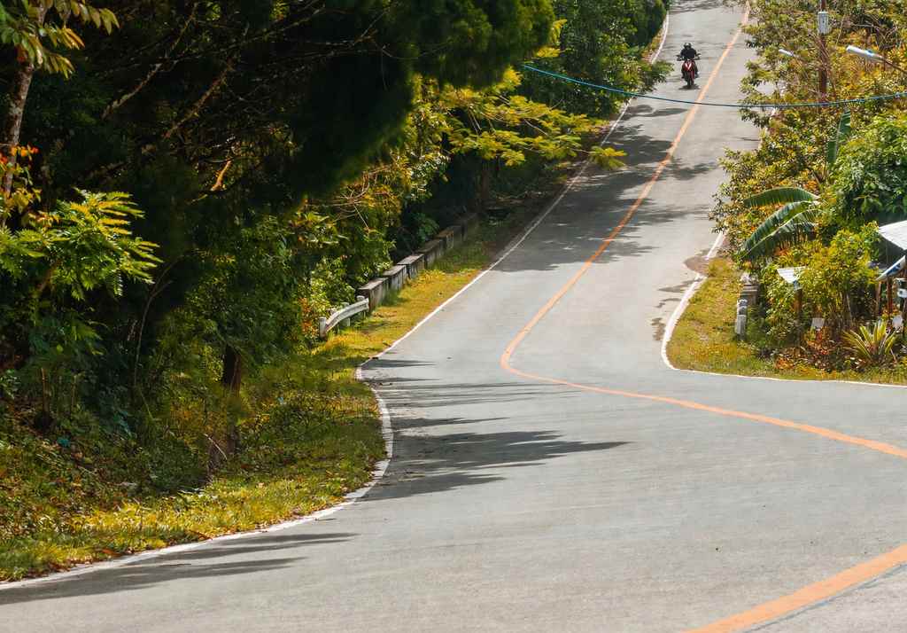
Most visitors start at the eco park in Barangay Sunog, also known as Baguio de Cebu. Drive the Transcentral Highway toward Balamban and, about 1.5 kilometres past the West 35 area, turn right at the Mt. Manunggal sign. The last stretch is almost 2 kilometres of narrow road, about three metres wide at its widest, with drop-offs on some bends, so drive slowly and let oncoming vehicles pass. From the camp area, the walk to the summit and monuments takes about 30 minutes. It suits families and first-timers, and a guide is optional.
The long climb from the Cebu City side
The traditional route starts from the river that divides Cebu City and Balamban, or from Cantipla and Tabunan on the Cebu City side. Expect between three and five hours up, and longer if you are slow or the ground is wet. Much of the Tagba-o trail has no tree cover and runs through upland farms, so it is hot and steep. This is also the route used for the annual Magsaysay death anniversary climb. The tracks branch through farmland, so hire a local guide, and start early enough to be down before dark.
Getting There From Cebu City
- By car or motorbike: Search "Baguio de Cebu Eco-Mountain Park Adventure" on a map app and watch for the Mt. Manunggal sign on the highway. Parking is available at the park.
- By van: V-hire vans to Balamban leave from the Ayala Center Cebu terminal. Ask the driver to drop you at the Mt. Manunggal junction. The last published fare was ₱120 per person and the ride took one and a half to two hours.
- Last stretch: From the junction, a habal-habal to the entrance was ₱50 in the most recent fares available. Prices have probably risen, so agree the fare and a pickup time before you set off. Ride-hailing cars are not a dependable way to reach the park.
What It Costs
Entrance to the eco park was about ₱50 per person in August 2026, down from ₱80 in earlier years, and camping was ₱50 per person if you bring your own tent. A guide was quoted at ₱400 for a group of up to five in 2019. The park has also offered air-conditioned rooms, listed at ₱2,500 for two people in 2023. These rates change and no official rate sheet is published, so confirm at the gate or by calling the park before you commit to an overnight stay. Carry cash and a power bank, since mobile signal comes and goes.
The Transcentral Highway: Drive It Carefully
The Transcentral Highway links Cebu City and Balamban as National Route 815, and it is a road of constant bends and climbs. It is prone to accidents and, after heavy rain, to landslides. On 16 May 2026 a slide covered the road in the afternoon and the highway was closed until crews cleared it later that day. After the typhoon that struck Cebu in November 2025, the highway was impassable for a stretch, several mountain barangays in Balamban including Sunog were cut off, and the mayor estimated two to three weeks of clearing.
In practice, that means checking the forecast and recent road advisories from the Balamban and Cebu City governments before you go, and leaving early so you are off the mountain well before dusk. Avoid the trip after days of heavy rain. Fog and slow trucks on the curves are routine, so do not overtake on blind corners.
Stops on the Way Up and Down
The first stretch of the highway passes the best-known Busay stops, and our Busay hills day trip guide covers the Temple of Leah, Sirao Garden and Tops, including fees and the order that works best. If Manunggal is your main goal, save those stops for the way back, when you are not racing the clock. Hikers who like the idea of a longer mountain day can compare it with the Osmeña Peak to Kawasan Falls traverse, a very different mountain day in the south of the island.
What to Pack
- At least one litre of water for the short walk, and two or more for the long climb
- Shoes with grip, because the road and trail turn slick after rain
- A hat and sun protection for the open Tagba-o trail
- A light jacket, since it can feel cold before dawn at the camp
- Cash in small bills for fees, fares and food
- A bag to carry your trash back down
Is It Worth the Trip?
If you want a big-view hike, Cebu has steeper and more scenic mountains. Manunggal is worth the drive if you want to stand where a significant moment in Philippine history happened, in a setting that still feels remote. Go on a dry weekday if you can, give yourself a full day, and keep the walk quiet and the camp clean.

Comments
No comments yet. Been here recently? Share a tip or ask a question.
Leave a Reply